Property Record
20 Maple Ave, South Bound Brook, NJ 08880
This Property Is For Sale
NEARBY LISTINGS FOR SALE OR LEASE
Property Detail
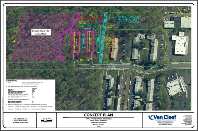
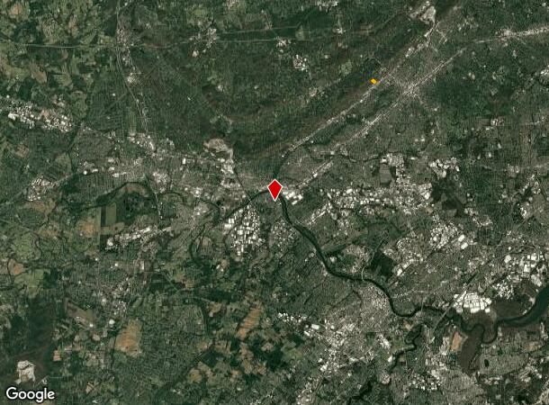
20 Maple Ave
09-00157-0000-00013-02
Somerset
Vacantlandnec
New Jersey
X
13.2
34023C0027F
6.70 AC
2024
Route 78 East
2025
Northern New Jersey
053000
Lakewood-New Brunswick, NJ
DEMOGRAPHICS near 20 Maple Ave
1 Mile
3 Mile
5 Mile
2024 Total Population
11,925
114,760
235,246
2029 Population
11,797
113,180
233,483
Pop Growth 2024-2029
(1.07%)
(1.38%)
(0.75%)
Average Age
39
39
40
2024 Total Households
4,060
36,502
78,351
HH Growth 2024-2029
(0.94%)
(1.38%)
(0.76%)
Median Household Inc
$84,293
$85,336
$111,039
Avg Household Size
2.80
3.00
2.90
2024 Avg HH Vehicles
2.00
2.00
2.00
Median Home Value
$357,287
$387,217
$456,678
Median Year Built
1959
1955
1961
Nearby Places
Map Layers
Map Styles
 Street
 Aerial
- Restaurants
- Banks
- Shops
- Fitness
- Groceries
PUBLIC TRANSPORTATION
COMMUTER RAIL
Bound Brook (Raritan Valley Line - NJ Transit Commuter Rail (NJ Transit))
DRIVE
WALK
Distance
Bound Brook (Raritan Valley Line - NJ Transit Commuter Rail (NJ Transit))
2 min
15 min
0.8 mi
Bridgewater (Raritan Valley Line - NJ Transit Commuter Rail (NJ Transit))
DRIVE
WALK
Distance
Bridgewater (Raritan Valley Line - NJ Transit Commuter Rail (NJ Transit))
5 min
2.1 mi
AIRPORT
Newark Liberty International
DRIVE
WALK
Distance
Newark Liberty International
40 min
32.7 mi
Trenton Mercer
DRIVE
WALK
Distance
Trenton Mercer
52 min
34.2 mi
Freight Ports
New York Container Terminal
DRIVE
WALK
Distance
New York Container Terminal
34 min
27.0 mi
Nearby Properties
Address
Land Use
TOTAL SIZE
Lot Size
Zoning
Address
Land Use
TOTAL SIZE
Lot Size
Zoning
31.49 AC
LI5
Address
Land Use
TOTAL SIZE
Lot Size
Zoning
6,625 SF
22.51 AC
B-I
Address
Land Use
TOTAL SIZE
Lot Size
Zoning
70.22 AC
B-I
Address
Land Use
TOTAL SIZE
Lot Size
Zoning
41.40 AC
LI5
Address
Land Use
TOTAL SIZE
Lot Size
Zoning
17.01 AC
B-I
Address
Land Use
TOTAL SIZE
Lot Size
Zoning
16,397 SF
41.98 AC
R20
Address
Land Use
TOTAL SIZE
Lot Size
Zoning
19.46 AC
B-I
Address
Land Use
TOTAL SIZE
Lot Size
Zoning
64.99 AC
LI5
Address
Land Use
TOTAL SIZE
Lot Size
Zoning
31.50 AC
B-I
Address
Land Use
TOTAL SIZE
Lot Size
Zoning
22.36 AC
PAC
Address
Land Use
TOTAL SIZE
Lot Size
Zoning
2,450 SF
26.84 AC
B-I
Address
Land Use
TOTAL SIZE
Lot Size
Zoning
22.75 AC
LC
Address
Land Use
TOTAL SIZE
Lot Size
Zoning
21.60 AC
LI5
Address
Land Use
TOTAL SIZE
Lot Size
Zoning
26.23 AC
B-I
Address
Land Use
TOTAL SIZE
Lot Size
Zoning
32.92 AC
B-I
Address
Land Use
TOTAL SIZE
Lot Size
Zoning
Address
Land Use
TOTAL SIZE
Lot Size
Zoning
38.35 AC
ER
Address
Land Use
TOTAL SIZE
Lot Size
Zoning
32,704 SF
44.53 AC
LI5
Address
Land Use
TOTAL SIZE
Lot Size
Zoning
24.34 AC
IND
Address
Land Use
TOTAL SIZE
Lot Size
Zoning
82.79 AC
M-2
Address
Land Use
TOTAL SIZE
Lot Size
Zoning
2,488 SF
16.46 AC
PAC
Address
Land Use
TOTAL SIZE
Lot Size
Zoning
26.53 AC
B-I
Address
Land Use
TOTAL SIZE
Lot Size
Zoning
230,022 SF
15.48 AC
LI5
Address
Land Use
TOTAL SIZE
Lot Size
Zoning
4.05 AC
Address
Land Use
TOTAL SIZE
Lot Size
Zoning
13.38 AC
B2
Address
Land Use
TOTAL SIZE
Lot Size
Zoning
275,431 SF
17.91 AC
LI5
Address
Land Use
TOTAL SIZE
Lot Size
Zoning
7,475 SF
20.98 AC
B-I
Address
Land Use
TOTAL SIZE
Lot Size
Zoning
17.65 AC
B-I
Address
Land Use
TOTAL SIZE
Lot Size
Zoning
235,855 SF
14.48 AC
B-I
Address
Land Use
TOTAL SIZE
Lot Size
Zoning
19.90 AC
IND
The World's #1 Commercial Real Estate Marketplace
Connect with us
© 2026 CoStar Group
The information above has been obtained from sources believed reliable. While we do not doubt its accuracy we have not verified it and make no guarantee, warranty or representation about it. It is your responsibility to independently confirm its accuracy and completeness. Any projections, opinions, assumptions, or estimates used are for example only and do not represent the current or future performance of the property. The value of this transaction to you depends on tax and other factors which should be evaluated by your tax, financial, and legal advisors. You and your advisors should conduct a careful, independent investigation of the property to determine to your satisfaction the suitability of the property for your needs.